
The city will have another look at its flood plain data for the sake of caution but is confident little will need to change in the wake of the province’s policy change on housing development within flood areas.
The province announced Sunday anyone who builds or rebuilds within identified 1:100 year flood plains in Alberta will not qualify for disaster relief in the event of a flood. The changes come on the heels of massive flooding last month in southern Alberta that has left many homes uninhabitable.
Stephen Khan, St. Albert’s MLA, confirmed Thursday that policy change is province wide, not just for those areas that recently flooded.
“The premier is very clear that the policy is not just for the area in southern Alberta. It’s a policy for all of Alberta moving into the future,” Khan said.
But city officials maintain the policy change should have very little impact on St. Albert. As the rules currently stand, building anything in St. Albert’s flood plain is forbidden.
“It’s pretty clear in the land use bylaw that it is prohibited,” said Carol Bergum, the city’s senior long-range planner. It does allow for some structures such as utility infrastructure or temporary outdoor shelters, but that’s about all, she added.
Bergum said the city is looking at its flood plain mapping and also reviewing maps in the province’s possession to make sure both are as up to date as possible.
“They are looking to ensure what we have as a flood line matches what the province has,” Bergum said. She said the city’s maps are likely more up to date than the province’s.
That’s because the city most recently updated its floodplain and any impacted bylaws in 2010. At that time, the city had received a series of reports on its flood zone and had been presented with four different options – the standard flood plain, and increasing by anywhere from half a metre to a metre-and-a-half.
Bergum said the metre-and-a-half option put a lot of structures into the city’s flood plain.
“Those really pushed that line really far into some existing development,” Bergum said.
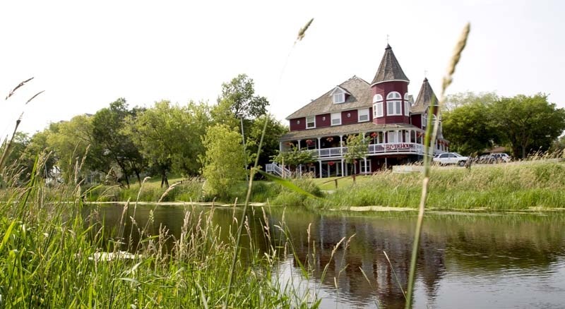
But the council of the day increased the flood plain by only a half-metre, which put only nine known structures, such as the River House Grill and Chateau Mission Court, in the flood plain, as well as eight total hectares of land. Prior to the adjustment there had been no buildings within the flood plain.
City manager Patrick Draper said there is little chance of a flooding within the 1:100 year flood plain as the city is a distance from the mountains.
“There’s some different factors, obviously,” Draper said. “That said, we are still working to update the information.”
He’s also asked staff to map out what infrastructure the city does not own is located in the flood plain.
“That will expand our awareness of what infrastructure is there beyond what is owned and managed by the city,” Draper said.


