
This past week, St. Albertans woke up to snow melting, birds chirping and the sun beaming down from the bright blue sky.
Spring finally arrived in the region, a bit later than usual, and it happened very quickly.
“It was sudden. Bam! It just happened all of a sudden,” Eric Dykes, meteorologist with Environment and Climate Change Canada, said.
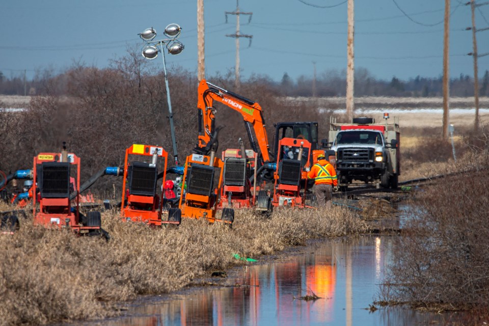
The past couple days of positively balmy temperatures contributed to seasonal flooding in and around St. Albert. On Monday, CN crews spent the morning just west of Ray Gibbon Drive assembling a series of pumps to remove standing water from a field adjacent to a rail corridor. CN couldn't provide an interview by press time.
Flooding was also spotted on Red Willow Trail under the Ray GibbonDrive bridge, where city crews were installing a large dam to help divert water away from the trail.
The month started off much cooler than a typical April, with the first day of April reaching a high of -11 C.
“That’s quite a cruel April Fools joke,” Dykes said.
As the month unfolded, the weather continued to stay unseasonably cool, with a high of -7 on April 5.
“It did warm up towards the ninth and tenth of the month where we saw highs around 8 C and 9 C. But then we fell back again on the 11th and 12th when they reached -1 C and -3 C,” Dykes said.
Finally the weather warmed up right before the weekend, to a high of almost 13 C last Thursday.
On Monday, temperatures soared north of 18 C.
While the sunshine and heat are welcome to many who have been locked down due to COVID-19, Dykes said the sudden change in temperatures makes the risk for ground flooding a bit higher. Dykes said if temperatures stay above zero overnight and then reach warm temperatures during the day, it allows for additional melting to occur.
“When the ground is frozen, the water has nowhere to percolate, to bury into the ground, and so it just kind of stays on the surface and can lead to areas of overland flooding in some cases,” Dykes said.
Dykes said across Alberta, there were some areas, like in the mountains, that had a high snowpack this year, which raises the risk for flooding when temperatures warm up quickly.
On Tuesday in St. Albert, the high reached 20 C, which Dykes said is warmer than expected for this time of year. The average high for mid-April is 14 C and the low hits around 2 C overnight.
The warmest April 21 on the books was recorded in 1942 when it hit a high of 26.7 C, while the coldest temperature was in 2008, when the mercury plummeted to -11.6 C.
On April 21 last year, the temperature hit 15.8 C and by April 22 it had jumped to 22.6 C.
While things in the region have warmed up, Dykes can’t guarantee we are out of the woods yet, and it is possible we could get snow again, although Dykes noted that there is no snow in the forecast for the next seven to 10 days.
On Wednesday, St. Albert was expected to see a high of 14 C with a mix of sun and cloud and a low of 3 C and clear at night. On Thursday, the city will see a high of 15 C and sunny with an overnight low of 4 C and a 30-per-cent chance of showers. On Friday, the high will hit 13 C and sunny with a low of 0 C.


